Mapping different historical points in Pasifika is a way of visualizing different kinds of movement through time and the space of our great ocean.
This is NOT a comprehensive mapping of historical activities from all islands. I focus on adding movement within these guidelines:
- The map should provide a broad sense of movements that is inclusive of Melenesia, Micronesia, and Polynesia.
- The map should provide relational context for our Pasifika communities in Southern California and the Indigenous Peoples whose lands hold us here.
Finally, I will note that the map includes specific points from Aitutaki and Pukapuka (Cook Islands) because those histories belong to my family. It is through my papa’anga (genealogy) that I best understand our histories.
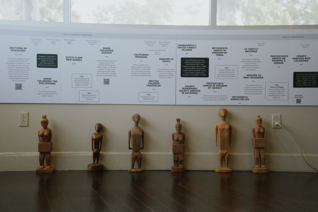
Print Edition
The linear print edition of Mapping Pasifika Histories tracks movement from the 16th through 19th centuries and is currently on view at the Pacific Island Ethnic Art Museum in Long Beach, California. At 12 ft long by 2 ft high, features audio segments that dive deeper into the Doctrine of Discovery, the 1898 Treaty of Paris, a protocol for learning together, and how to approach historical research as a Pacific person.
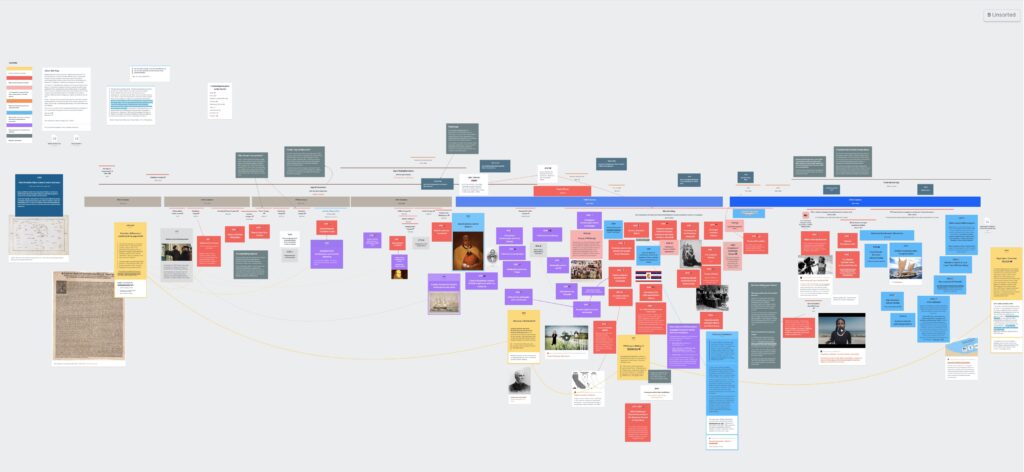
Digital Edition
The spiral version is a living project that continues to be updated from time to time. Please see the change log embedded in the map for the most recent updates.
Both digital editions of Mapping Pasifika Histories are best viewed on a desktop computer or tablet.
- A password is required to access the digital map. To request the password, please email info@pasifikahistories.org.
- You do not need to be a Milanote user to view the map, however, registering for a free account does make it easier to navigate.
Questions? Please email info@pasifikahistories.org.

Print and digital editions of Mapping Pasifika Histories are © 2025 Melodie Bergquist-Turori, All Rights Reserved.